
Trip Report: Dirty Devil SOLO LOOP
Miles Hiked: 16.5 Miles
Miles Paddled: 10 Miles (+ 10 optional)
Dirty Devil River: 95cfs

WAYPOINTS
Parking Lot Flint Trail 4x4
N 37.898917° W 110.378096°
Rock Canyon Wash
N 37.936604° W 110.335616°
Exit Crack
N 37.961364° W 110.331691°
Jenga Cairn
N 38.017730° W 110.334789°
Fiddler’s Canyon Descent
N 38.042641° W 110.376185°
Dirty Devil @ Fiddler’s Cove
N 38.043753° W 110.399080°
Hog’s Bench
N 37.972941° W 110.400418°
Day 0: Reconnaissance
The day before the trip, I made the long 7+ hour haul across I-70, from Denver to Hite. Despite the hellacious ski traffic (even at 4:00am!), I arrived in Hite a little before 2:00pm. Honestly, the drive from Hanksville to Hite was easily top 5 most scenic drive’s I’ve ever taken. I was quite literally hanging my head out the window at times in awe, and I’ve been on some pretty epic drives already. If you ever get the chance to take this scenic section of road, don’t pass it up!
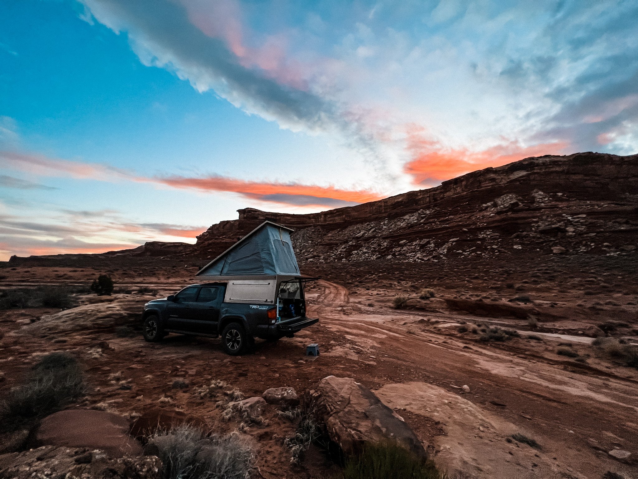
The plan was to hike in over 1-2 days, drop in the Dirty Devil at Fiddler’s Cove, then spend 2 days paddling 20 miles back to the bridge. So, when I arrived in Hite I scouted my original takeout point (info at end). After scouting, I headed up the Flint 4x4 Trail to find where the Hayduke leaves the road and into Rock Canyon via a wash. I camped here for the night.

Dirty Devil as seen from south end of bridge.

Bridge as seen from take-out ledges.
Proposed take-out as seen from north end of bridge.
Day 1: Flint Trail 4x4 - Red Ledges (Hayduke Section 4)
I figured I would maximize my potential on Day 1 and leave my giant pack where I camped at the intersection of the Flint 4x4 Trail and Hayduke Trail / Rock Canyon Wash. I drove the truck back to the parking lot by the road for a better takeout, and it was a quick 90 minutes back to the pack.
*Important Logistical Detail: I carried 9 liters of water, Fiddler’s Canyon was completely dry, despite it raining and snowing only 3 days before. I brought alum as backup, but I walked out with my last liter.
The wash was wide and open, gently winding up the canyon as the walls slowly grew taller and more narrow. The walls of the canyon easily towered thousands of feet above me, but the wash I was following was it’s own unique experience. Twelve to twenty foot walls formed from torrential flash floods. Boulders the size of Cadillacs peppered the wash, tossed about in the last flash flood like a beach ball.

Wash leading to Rock Canyon as seen from Flint Trail looking N

Entrada Sandstone in the lower wash

Entrada Sandstone in the lower wash


A HUGE boulder marks the cove along the eastern canyon wall with the exit crack (N 37.961364° W 110.331691°). The exit crack is on the north-east aspect of the cove, about half way up the scree and talus field, a large cairn can be seen on the rim of the ledge below the crack. Despite it being referred to as Class III in several guides, it was an easy exit; a couple jug holds, and a little stemming and you’re up! I found it easiest to do a 180* turn between the first and the second move.
The geology of Rock Canyon was a mix of Entrada Sandstone (red) and Navajo Sandstone (Beige). I’m no geologist, but this is my understanding from research of the area. NPS Geodiversity Atlas

Perspective: Hauling my first round of gear up the exit crack
Exit crack ledge cairn, looking down on “HUGE boulder” (center)
The crack is very narrow, and requires hikers to haul their pack up separately. Anticipating this, I brought my most expensive, rare, custom item of gear that I own: an Ikea bag! Arriving on the ledge below the crack, I removed my packraft, PFD, paddles, and 5L water bladders from my backpack and loaded them into the ikea bag. From a comfortable ledge at the top of the crack, it’s only about a 10ft haul directly up. I used about 30ft of 550 cordage and a carabiner.

Looking across the infinite canyons I eventually crossed. Still not sure how? Henry Mountains in background.
Red Benches behind me
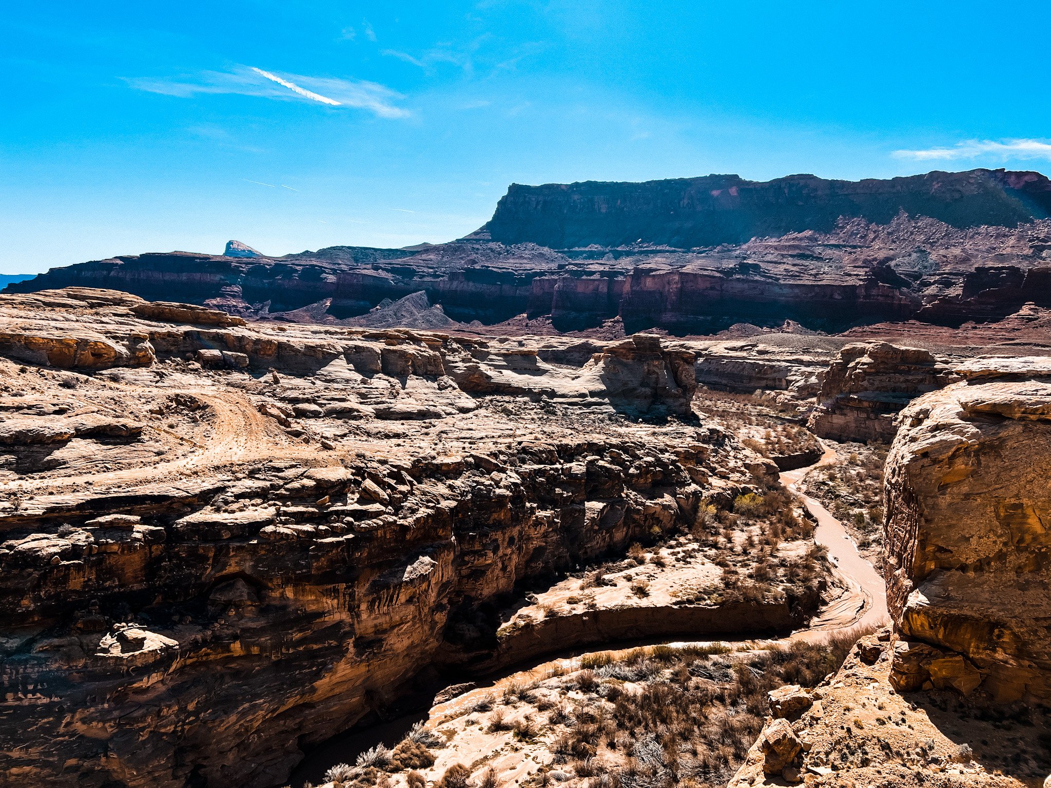
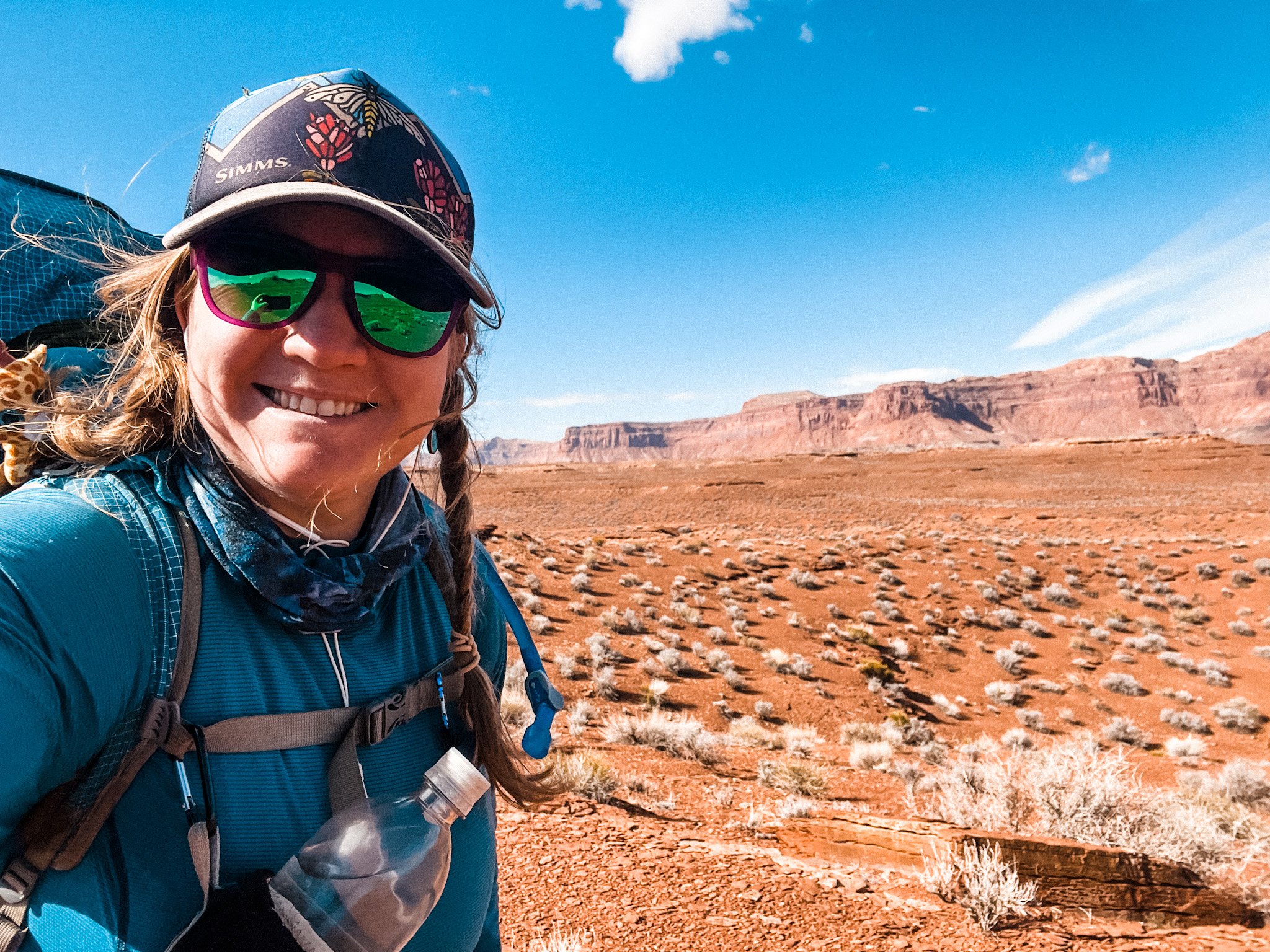
After exiting the crack, a few steps up the sandstone and I make it out the infamous Red Ledges, a 4 mile stretch of infinite canyons, ledges, scree, talus, and sand - so much sand. There is no trail, you are more or less heading in a general direction at this point, and you are simply brought to a canyon’s edge and must essentially find a way across it. The canyons themselves weren’t too difficult to navigate, but it was incredibly slow going in the sand with such a large pack. At one point, I thought I had made a huge mistake and considered turning around when I came to my 9th or 10th canyon rim. Buuutttt, after a snack, some water, and a few satellite texts from friends, I made it to the last wash of the Red Ledges just in time to make camp. Past this was another 5 miles across more mild terrain to the Fiddler’s Cove descent trail, and another 2 miles to the river. I did about 12ish miles the first day, and I slept like a rock (te he he).
Day 2: Red Ledges - Fiddler’s Cove

Finally got to see Jenga Cairn in real life!
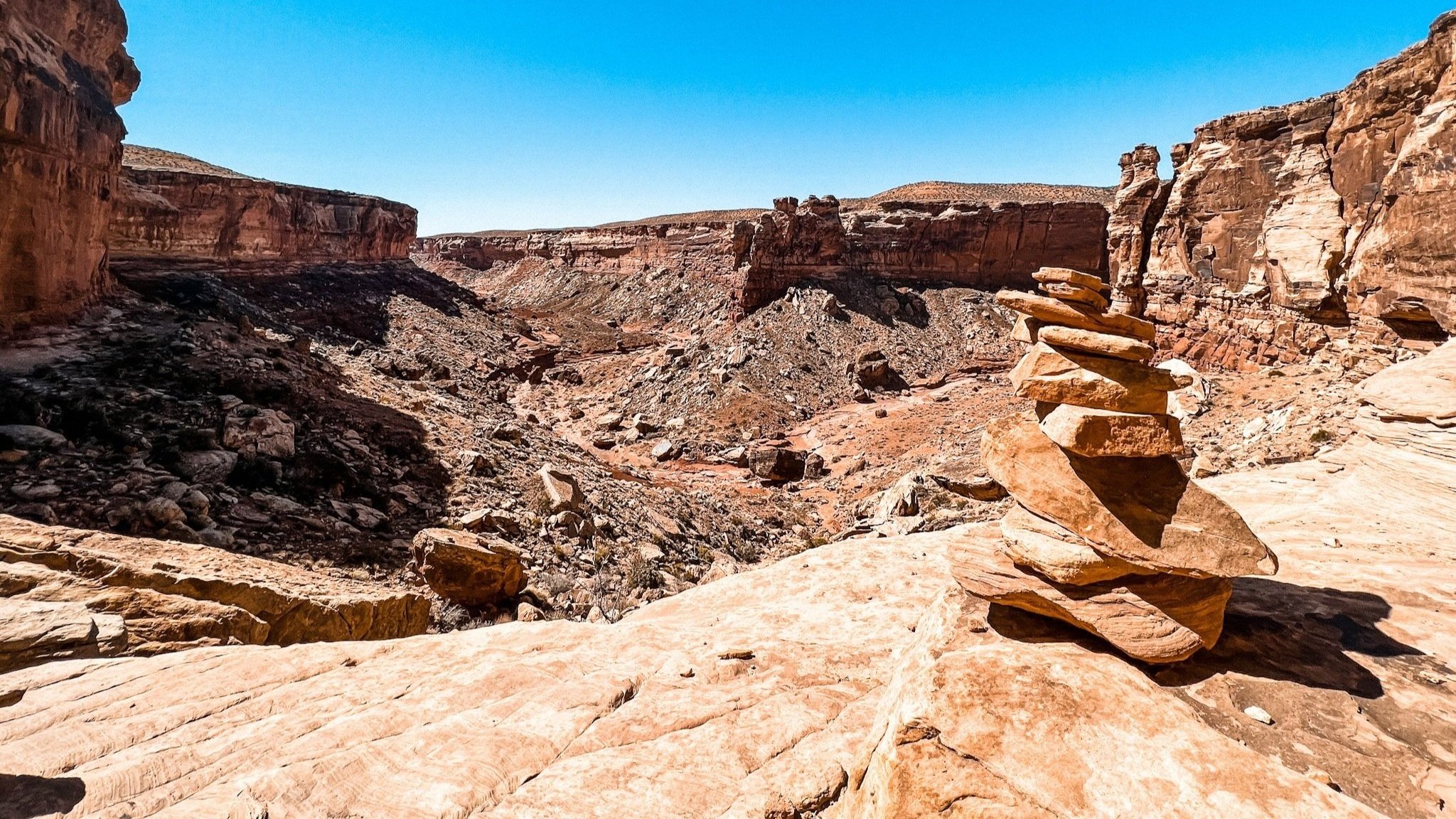
Day 2 started with a stunning sunrise accompanied by wind gusts so strong they blew me over on a few ridgelines, but I was happy to be hiking and not paddling at that point! Jenga Cairn (N 38.017730° W 110.334789°) marks the departure from the Red Ledges, and a change of course to the NW towards the entrance of Fiddlers Cove. While the CalTopo and Hayduke maps show the trail dipping down into the canyon and back up again, I chose to remain high on the canyon walls just south of the guidebook trail, following the spines, until I found the wee-little cairn that marks the decent into Fiddler’s Cove (N 38.042641° W 110.376185°).
The descent to Fiddler’s Cove is steep and rocky. Despite the more obvious looking routes on the topo, the descent actually bears a hard left down the canyon wall, eventually spitting you out on what I call an “Escalante Staircase”, and then down to the canyon floor. Don’t follow the topo map in the Hayduke guidebook, continue to bear hard left and the trail will be obvious.

Descent crack into Fiddler's. Trail ends photo lower right.

The only shade I found that day until I hit the river!
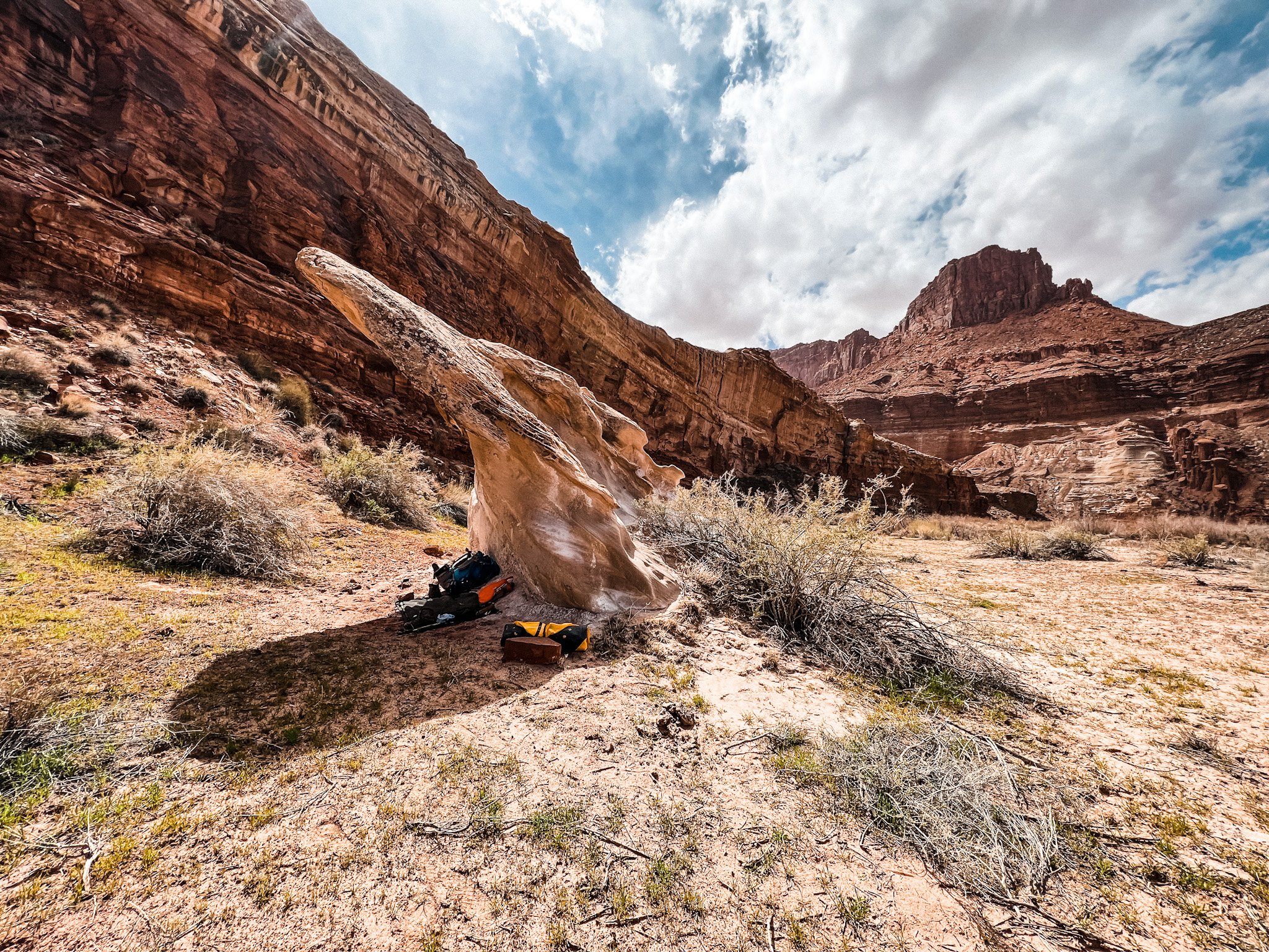
Once I was in the canyon, it was a quick couple miles up the wash towards the river. Don’t worry, you’ll know you’re going the right way as the wind gets more aggressive and blows more and more sand in your face - haha. Me, bitter? Never! Speaking of sand, there was a full sandstorm coming up the canyon when I got to the river! I ended up following some cattle tracks (those cows know where all the good stuff is) to what I lovingly named “potato-chip rock”, an almost flying saucer shaped rock near the canyon wall that was clearly the only wind-protected spot in the area. I debated going a couple miles back up the canyon to camp, but ultimately I wanted to be near the river for easy staging the next morning. The afternoon was brutal with the wind and I was pretty much sequestered to my rock shelter for the afternoon.

Sand storm on the banks of the Dirty Devil
My own little potato chip.
Day 3: Fiddler’s Cove - Hog’s Bench
Day 3 -finally time to get the boat out and paddle! With only mild winds in the forecast and a dropping cfs of 95, I decided to risk the headwind and paddle that day. At this point, the plan was to paddle 2 days out, camping overnight at Hog’s Bench about half way down to the bridge.
The morning was cold, so I made quick work of packing my gear into the raft and getting it inflated. I knew once the afternoon warmed up, the winds would be back. So, around 8:00am and 35*F and 95cfs, I launched on the Dirty Devil River! P.S. I forgot to lube my zipper, and enjoyed some blow-tube action every hour.


Honest report about running the river at 95cfs: tolerable. The canyons were incredible, each bend and turn bringing new formations, and long stretches of classic Escalante Walls. There was a decent amount of dragging. And by decent, I mean that at one point I was letting my boat float along behind me, and I started calling it like a dog “Here girl! Come on!”. It was cold the day I paddled, barely making it over 40, but my drysuit was plenty warm for the occasion. DO NOT FORGET PADDLE GLOVES! Thats my only PSA for this trip!
95cfs is probably the absolute lowest I would run this section. I averaged about 2mph with floating, dragging, and stopping. I got up to about 2.5mph in the places I could paddle.
After about 5 hours on the river, I pulled out at the south side of the river, near the Hog’s Bench 4x4 Road (N 37.972941° W 110.400418°). Here, I used my fabulous, irreplaceable Ikea bag once again to haul my gear up from the river. After looking at the upcoming temps, considering the additional drop in cfs, and my dwindling food bag, I decided to hike out from here back to the truck, instead of paddling the additional 10 miles.


Exit at Hog’s Bench
Day 4: Hog’s Bench - Truck (Flint Trail)
Last day of this spirit quest was a quick walk up about 4-5 miles of 4x4 road, accompanied by 1 mile road walk back to the truck. I mean, it wouldn’t be a true spirit quest if I didn’t have a little road walking - right? Not much else to say! I hope you enjoyed the report and photos, happy paddling!

Resources
American Whitewater: Dirty Devil
BLM office in Hanksville:
380 S 100 W Hanksville,
UT 84734 (435) 542-3461
Blogs
Inspiration and beta credit goes to Dean Hill and his blog post here.